Head of Christiana Cemetery in Newark, Delaware, has an illustrious history that dates to the early 1700s. Now ground penetrating radar services are helping the cemetery staff unpack that history, confirming burial locations and finding unmarked graves of Revolutionary War soldiers.
For historic cemeteries like Head of Christiana Cemetery, maintaining accurate and complete records is nearly impossible. While not all cemeteries can trace their founding to pre-Revolutionary War years, many of today’s cemeterians struggle to fill gaps in their records and fully understand the histories of their cemeteries.
For these cemeterians, ground penetrating radar offers a glimpse into the past, uncovering the well-kept secrets of their cemetery grounds.
So what is ground penetrating radar? And how do cemeteries use GPR to find lost graves and improve their maps?
What is ground penetrating radar?
Ground penetrating radar, or GPR, is used to find underground anomalies—such as unknown burial locations, hidden objects, and water or utility lines—without disturbing soil. These radar systems send series of pulses over a defined area (like a section of a cemetery) to create scans and detect subsurface materials.
Because GPR investigates areas of interest without digging, excavating, or disrupting the ground, it is a safe and effective surveying method for sensitive sites. It can be used to detect geological features and changes in ground strata, underground pipes and unmarked utilities, air pockets and voids, groundwater tables, and materials like concrete, metal, plastic, and PVC.
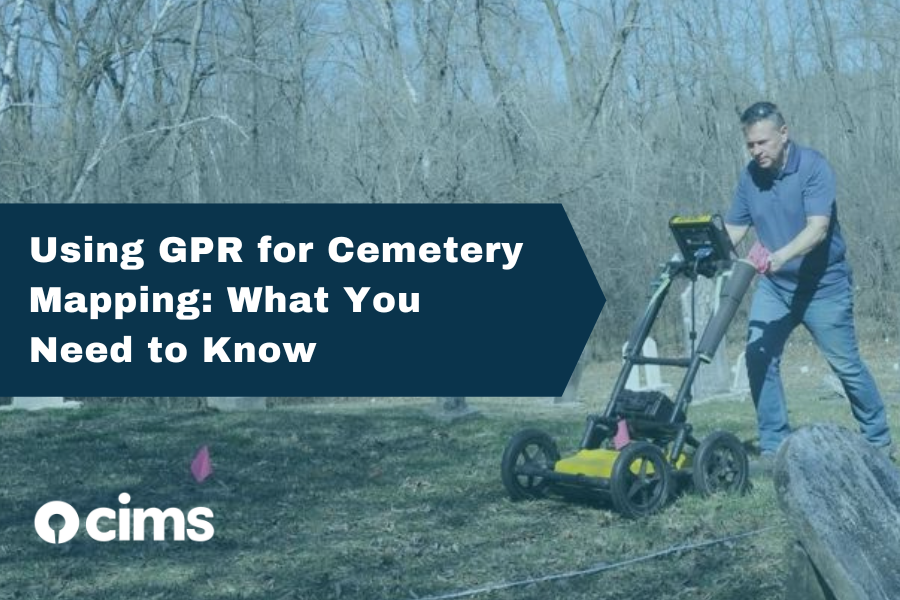
GPR systems are invaluable tools in the toolkits of cemetery managers at older cemeteries. These devices can confirm burial locations and casket positioning, scan new areas for hidden objects (like buried headstones and lost graves), and increase the overall accuracy of cemetery maps. Since GPR equipment is expensive—often costing more than $30,000—and it takes many hours of training to use GPR properly, cemeteries often hire ground penetrating radar experts for mapping projects.
How does GPR work?
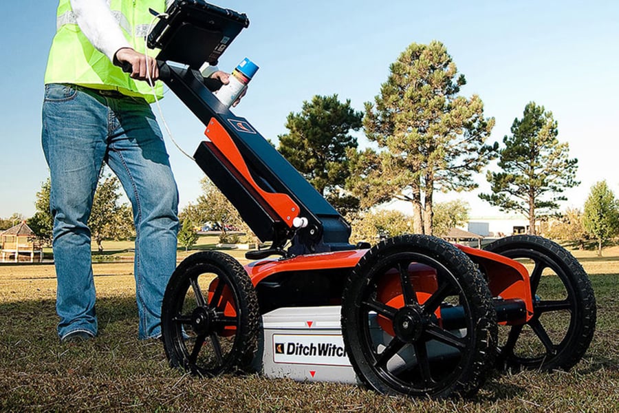
Ground penetrating radar equipment sends electromagnetic pulses into the ground and records any reflected or refracted signals produced by underground objects. In other words, when the signals created by the ground penetrating radar system meet materials below the surface, the pulses are disrupted. GPR uses software that records and measures these scattered signals (which are captured by the device’s antenna), translating any variations into images of subsurface objects. These images are then used to map buried materials, such as utilities, headstones, or even unconfirmed burials.
Most ground penetrating radar systems resemble the humble push mower. And like push mowers, these systems often require manual force to propel them forward. That being said, operating a GPR takes more than human force and a can-do attitude. If you’re interested in using a ground penetrating radar at your cemetery, contact a GPR expert for help.
Finding unmarked graves with GPR
It’s common for cemeteries that have been around for hundreds of years to have incomplete records. After all, many cemeteries with long histories have had generations of record keepers—and some of those record keepers may have been less detail-oriented than others. Modern cemeterians must contend with missing or destroyed burial records. Add unmarked graves and buried headstones to the mix and mapping an older cemetery can prove to be a major undertaking.
GPR helps cemeterians address these problems and find lost graves without disturbing their cemetery’s landscaping. A common technology for grave detection, GPR accurately detects most interments. Although graves older than 70 years or without a concrete vault can be difficult to locate, trained GPR operators are able to spot anomalies in the soil and surroundings to detect signs of a burial.
Adding GPR findings to your cemetery maps
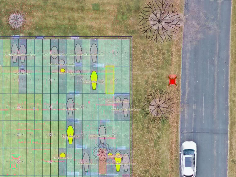
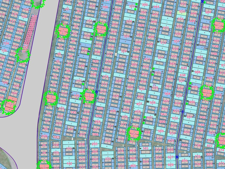
Even historic cemeteries take advantage of modern technology. If your cemetery uses management software with digital maps (like CIMS), GPR findings can easily be entered into your online database. Adding this data gives cemeterians a real-time picture of which plots are occupied or obstructed, which ones have been sold, and which ones are available.
Members of the GIS mapping team at CIMS help cemeteries analyze GPR scans and identify exact GPS coordinates of unknown burials, buried headstones, and other anomalies. The CIMS team then incorporates this data into each cemetery’s online map, filling gaps in their historical records.
Ready to gain a better understanding of your cemetery?
CIMS helps cemeterians survey their grounds and improve their digital cemetery maps with ground penetrating radar services. Get an estimate for ground penetrating radar at your cemetery.